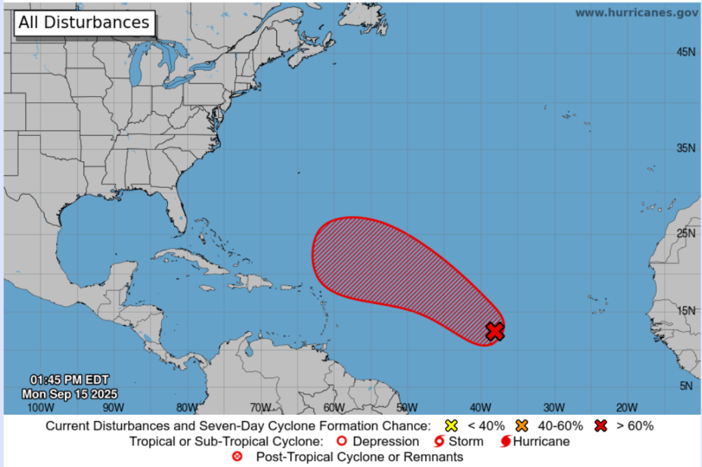
There is an area of interest AL92, associated with showers and thunderstorms approximately midway between the Windward Islands and the west coast of Africa.
At 3:00 pm today, Monday 15th September 2025, the broad centre of the disturbance was located near 39W or approximately 2100 km east of the Southern Windward Islands. There is a medium (50%) chance for the formation of a Tropical Cyclone over the next two (2) days, with a high (90%) chance over the next seven (7) days. The system is moving towards the west northwest at 16-24 kph and is expected to move north of and away from Trinidad and Tobago.
As the system nears the Eastern Caribbean Islands, depending on its track, it can influence the weather over Trinidad and Tobago, which may include moderate to heavy showers and thunderstorm activity.
THERE ARE CURRENTLY NO WATCHES OR WARNINGS ON THIS SYSTEM, IN EFFECT FOR TRINIDAD AND TOBAGO.
The TTMS continues to monitor this area of disturbed weather and will issue an update at 3:00 pm, Tuesday 16th September 2025, or earlier if the situation warrants. As always, pay close attention to information being issued by the TTMS by visiting www.metoffice.gov.tt, and the ODPM website https://www.odpm.gov.tt
The following graphic is courtesy NHC: https://www.nhc.noaa.gov/