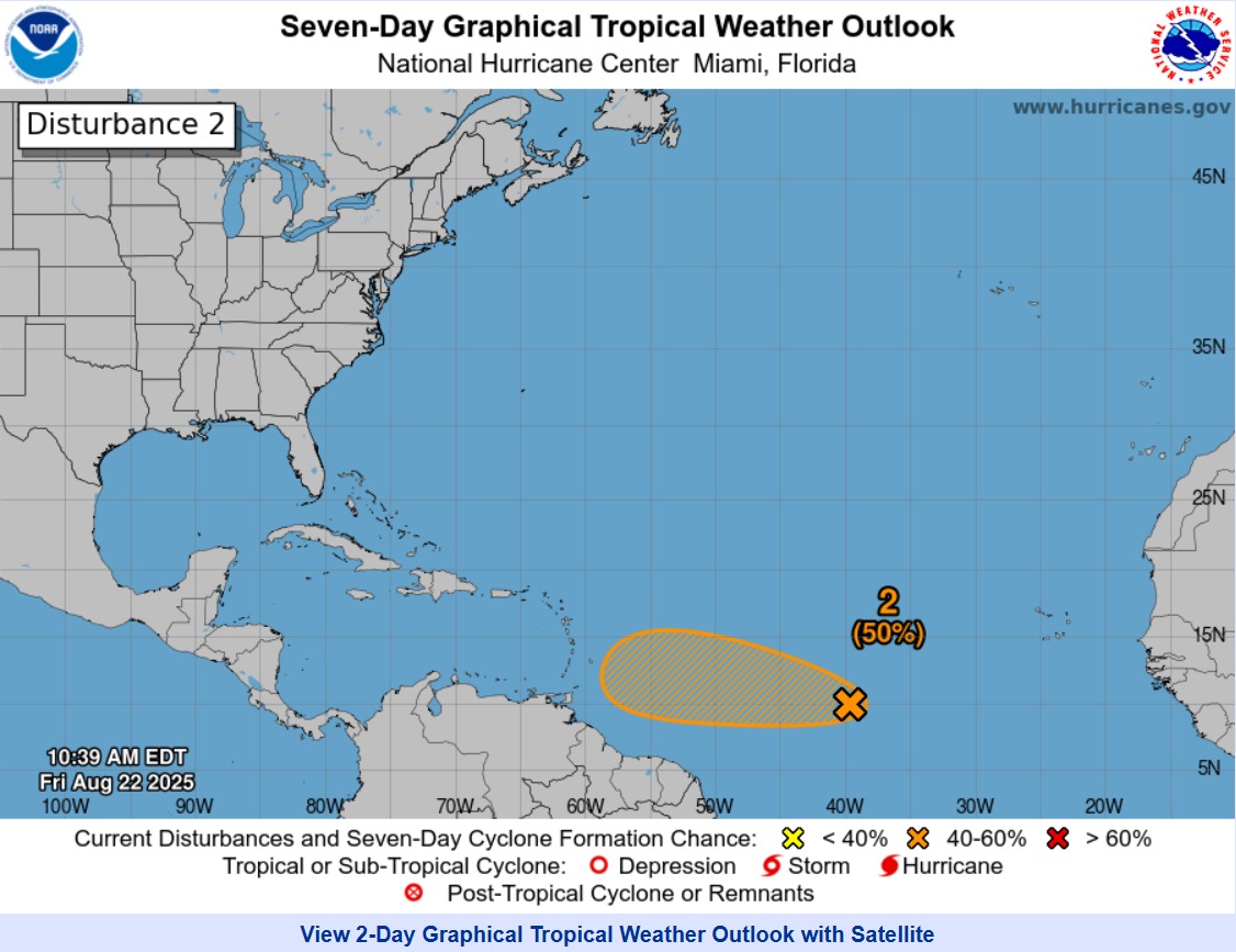
There is an area of disorganized showers and thunderstorms associated with an active Tropical Wave, approximately 2100 km east of the Lesser Antilles, moving westward at 16 – 24 kph.
At 11:00 am today, Friday 22nd August, 2025, the broad centre of the disturbance was located near 42W or approximately 2100 km east of the Southern Windward Islands. There is a medium (40%) chance of development in the next two (2) days, with a marginal increase (50%) over the next seven (7) days.
A short-lived Tropical Depression could form over the next day, but the system is expected to move into a less favorable environment for development by Saturday. The environment could become favorable for development by late weekend into early next week as it approaches the Lesser Antilles.
Regardless of development, the likely weather for Trinidad and Tobago includes periods of moderate to heavy showers and thunderstorm activity.
THERE ARE CURRENTLY NO WATCHES OR WARNINGS IN EFFECT FOR TRINIDAD AND TOBAGO. The TTMS continues to monitor this area of disturbed weather and will issue an update at 9:00 am tomorrow, Saturday, 23rd August 2025, or earlier if the situation warrants. As always, pay close attention to information being issued by the TTMS by visiting www.metoffice.gov.tt, ODPM by visiting www.odpm.gov.tt and following us on our social media platforms.
https://www.metoffice.gov.tt/early_warning